Go to text
Go to tabs
Go to menu
Go to Search box
Politique d’accessibilité du site
Navigation menu
Navigation menu
Contact
Go to Search box
RedGems
Re-Emergent Diseases Global Environment Monitoring from Space
Search this site
Keywords
In group:
essentiels
MotCles
multirubricage
Diseases
Covid19
Rift Valley Fever
Vibrio Diseases and Cholera
Malaria
Dengue
Geography
Space Tools
State-of-the-art
Remote sensing
Data collection
Altimetry
Projects
Telemedicine
Tele epidemiology
Partners
Home
Documents
Documents
All media
Images (110)
Videos (1)
Other (41)
Type
Titre
Description
Poids
Rattaché à
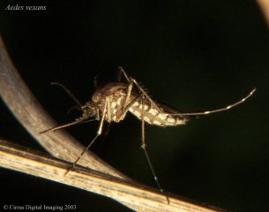
Aedes vexans mosquitoe (photo : Bruce Marlin Cirrus Digital Imaging 2003)
11.1 KiB
What is Rift Valley Fever ?
all article in Pdf
831.6 KiB
Remote Sensing and Human Health: New Sensors and New Opportunities
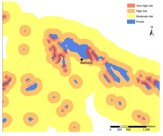
ArcView conversion, data management, and analysis tools ArcView conversion data management, and analysis tools enable the display of an improved three-zone ZPOM for potential Rift Valley fever risks. The very high risk zones are red-hatched to identify underlying pond limits.
42.5 KiB
GIS and High-Resolution Remote Sensing Improve Early Warning Planning for (…)
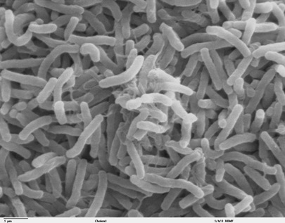
Cholera bacteria
Source: http://remf.dartmouth.edu/images/bacteriaSEM/source/1.html This (…)
41.5 KiB
Cholera, a example of Vibrio disease
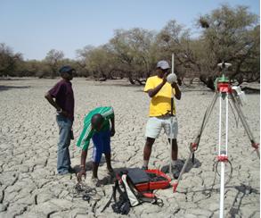
Collecting DEM data in Niaka pond with a GPS Leica 500
18 KiB
Barkedji study area, Senegal
Distribution of dengue, Eastern Hemisphere - CDC
38.9 KiB
Where is Dengue ?
Distribution of dengue, Western Hemisphere - CDC
22.8 KiB
Where is Dengue ?
Fig. 1. Geographical location and satellite image from LandSat 5 TM (25
th
January 2004) of the city of Tartagal
104.3 KiB
Tartagal study area
Fig. 3 Villages with similar land cover risk in their 500 m buffer zones
837.8 KiB
Choice of study area
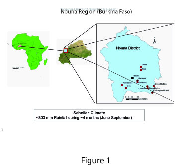
Figure 1
598.5 KiB
Malaria and infectious diseases in West Africa during the 21st Century
1
…
7
8
9
10
11
12
13
14
15
16
Home
Climate and Environment
Atmosphere
Cryosphere
Hydrosphere
Biosphere
Lithosphere
Contact
Back to top
